

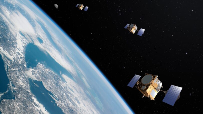
In the face of escalating environmental threats, such as massive deforestation, biodiversity loss, ocean pollution, and increased concentrations of planet-warming greenhouse gases (GHGs), satellites emerged as powerful allies helping safeguard the planet. Equipped with advanced imaging systems, they provide an excellent vantage point to take inventory of Earth’s surface in all its diversity – from polar ice caps to oceans to impenetrable forests – for a nuanced understanding of its unique ecosystems and tracking environmental changes alongside their core drivers.
By now, Earth-observing satellites have become an integral part of traditional environmental research and action programs, allowing scientists, governments, and NGOs to leverage their key advantages: worldwide coverage, near real-time unobtrusive observations, and the ability to spy on remote areas and detect events hidden from the human view. This article will explore the range of environmental uses of satellites aiding in combatting climate change and facilitating climate-protection measures.
Precision farming – a step towards more sustainable food production
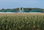
Agriculture drains the planet’s resources to produce food, driving deforestation, soil degradation, and water pollution on a massive scale. It also accounts for 12% of the world’s total GHG emissions, acting as a blanket that warms Earth and fuels climate change. Ironically, what goes around comes around: all of the above eventually takes a toll on agricultural productivity, claiming a large chunk of annual global crop yields. Precision agriculture holds the potential to turn the tide through informed crop and field management decisions focused on sustainability. By leveraging the satellite monitoring of crops, variable rate application (VRA) of inputs, GPS-guided machinery, and Big Data analytics, growers can reap bigger yields with fewer inputs and reduce the environmental footprint of their activities.
How does it work? Precision farming is grounded in the idea that croplands inherently vary, and a precise analysis of crop and field conditions is needed to accurately meet their vital input needs. Through the use of agriculture monitoring systems, which supply data from remote and on-field sensors, and specialized crop monitoring software that converts it into an action plan, farmers can give their plants and soils customized care to ensure optimal growth and maximize farm efficiency. Aside from a tangible cut on labor, input, and fuel costs, the environmental benefits of this sustainable farming strategy are plenty as well. Reduced fertilizer runoff and chemical pollution, decreased emissions from machinery, and alleviated pressure on natural resources are some of the significant positive impacts.
Climate modeling and prediction
Alongside agricultural monitoring, satellites prove indispensable in climate science, continuously providing real-time data on atmospheric phenomena: temperature, precipitation, aerosols, water vapor, wind speed and direction, storms, cyclones, etc. By equipping climate scientists with the essential input information for climate modeling, satellites enhance our ability to look into the future and predict various climate scenarios. And the more sophisticated the space-based technologies get, the more in-depth insights we’re able to derive.
Satellite data refines our understanding of the rate, scale, and effects of climate change on all continents and beyond – observe and track minute changes in sea levels, ocean acidification, polar ice melting, vegetation cover, intensity and frequency of weather calamities, and even animal migration patterns. By knowing what is going on now, we can more accurately predict what will likely happen in the short and long run. Such satellite-enabled climate predictions provide strong evidence for planning mitigation efforts and pushing conservation policies and international treaties forward.
Detecting Greenhouse Gas emissions from space
Numerous climate and meteorological agencies unanimously stated that 2023 was the hottest year on record, drawing attention to what keeps warming our planet – greenhouse gas emissions. Satellites have recently come to the rescue as a game-changing tool addressing the lack of accurate and consistent emissions data to facilitate tracking and verifying companies’ compliance with the 2015 Paris Agreement.
Multispectral satellite spectrometers can identify and quantify carbon dioxide (CO2), methane, and water vapor emissions globally, accurately pinpointing the source of gas leaks and global GHG “hotspots”. Merging satellite sensors with terrestrial and airborne sensors allows for building an integrated observation system to enhance the accuracy of GHG emission measurements and pave the way for holding the emitters accountable. Satellites provide objective, independent data that can be utilized more extensively to reach our climate goals through increased transparency and a more climate-friendly approach across all industries, from urban planning to oil mining.
Supporting sustainable land and resource management
Satellites play a crucial role in taking inventory of Earth’s land features and natural resources, enabling mapping of water bodies, vegetation cover, human settlements, depth and extent of snow and ice. By analyzing decades’ worth of satellite data on land use, we can track and measure changes, such as deforestation, urban expansion, and shrinking of rivers and lakes, to evaluate the environmental impacts of climate change and human activities. Insights derived from remote Earth observations support the development and implementation of sustainable land management plans at national and global scales. With nearly one-third of Earth’s land surface being altered by human activities within the last millennium – mainly due to agricultural and urban expansion – conservation efforts must be put front and center to balance the harm done to biodiversity and natural resources dwindling by leaps and bounds.
Bringing transparency to the carbon markets
Carbon offsets are widely recognized as a significant means to counterbalance CO2 emissions and halt global warming. The carbon project’s success relies on accurate measurement and monitoring to ensure that carbon sequestering practices are efficient and in place, and that’s where satellite imagery comes into play with its precise global data.
Among the key benefits of satellites from the viewpoint of carbon offsetting is their ability to monitor large areas and paint a comprehensive picture of land-use changes quickly and accurately. Satellite imagery provides visual evidence of implemented practices facilitating the verification process. In terms of measurement, it also offers a cost- and time-effective alternative to extensive ground-based surveys traditionally utilized for baseline and subsequent carbon measurements or carbon quantification based on yearly averages. In agricultural landscapes, satellites can deliver double benefits, enabling agriculture monitoring and incentivizing climate-savvy farming through easier access to carbon credits.
Challenges and opportunities ahead
The potential of satellite and space technologies in preserving Earth is boundless; however, certain hurdles remain on the way to fully unlock it. To expand satellites’ role in environmental preservation, we must continuously advance technologies, increase and successfully maintain the scope of satellite fleets in orbit, and ensure easier access to and interoperability of satellite data.
And while we’re trying to leverage space for driving sustainability on Earth, we should ensure these tools are sustainable too. As more and more satellites have been shooting into space recently, the term “space sustainability” highlighted the necessity to make space launches greener and safer both for Earth and space. Switching to less toxic rocket fuels and satellite propellants that emit fewer amounts of GHGs, employing reusable launch vehicles, and getting space regulators and governments to enforce stricter, more relevant space regulations to eliminate the looming threat of space debris are the critical steps for staying true to sustainability goals.
That solved, space can eventually play an even more significant part in lifting humanity out of its most pressing climate, environment, and food security challenges. For instance, many believe that space-based solar power stations are bound to solve our energy issues as a great alternative to terrestrial solar energy due to 24/7 direct access to sunlight.
The silent Earth observers – satellites – serve as powerful magnifying glasses, enabling us to see environmental issues more clearly and in more detail. The integration of satellite technologies at the core of our fight against climate change provides major stakeholders with a steady flow of high-quality, actionable insights that prove invaluable in reducing the environmental footprint of core industries. By leveraging satellites for various sustainability-promoting activities, from crop health monitoring to tracking carbon dioxide emissions, humanity can shape a greener future through more efficient and viable environmental protection strategies.